Book talk- Geology Underfoot in Western Washington

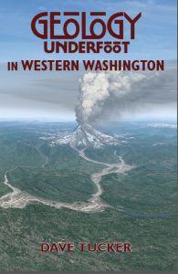
GUWW cover

Next book presentation by Dave Tucker*:

Camano Island Library

Saturday, April 21: 10:00am – 12:00pm

848 N. Sunrise Blvd., Camano Island, WA 98282

Directions here.

*Yes, alive and well.

Calling citizen scientists: Cascade snow survey

Susan Dickerson-Lange (WWU alum) is working toward a PhD at the University of Washington involving snow hydrology and would like your help. Read below.

_____________________________________

Are you planning any mountain adventures this spring and summer?  We are looking for help from outdoor enthusiasts to collect snow observations as the snowpack melts across the Pacific Northwest.

We need on-the-ground observations of snow presence in forested and open areas, and are looking for hikers, skiers, snowmobilers, and mountaineers to contribute.

Simply take geotagged photos of snow (or no snow) in adjacent forested and open areas and send them to:

uwsnowresearch@gmail.com

…or submit written observations via an online or paper form.

For information, including about geotagging, and a short training video:

http://depts.washington.edu/mtnhydr/research/citsci.shtml

Please spread the word, and contact me if you have any questions or ideas!

thanks,

Susan

____________________________________

Susan Dickerson-Lange

Mobile:  (253) 225-9909

Twitter:  @SDickersonLange

Ph.D. Student, University of Washington

Civil and Environmental Engineering

Mountain Hydrology Lab

http://students.washington.edu/dickers/

The Seattle mammoth tusk – a first hand account

Photo from Burke Museum Facebook page.

Photo from Burke Museum Facebook page.

Whether you were caught up in the ballyhoo over last week’s mammoth tusk find in Seattle, or not, you may find a first-hand report by UW biology grad student Dave DeMar of interest. Dave was one of the small crew who excavated the tusk. Click to read Dave’s posting. Also, here is a link to a Burke Museum Facebook page with a number of photos of the excavation and rescue: including cute kids cheering and showing their fan club banners. Prominent in the photos are advertizing banners hung in the pit by the various contractors associated with the construction project. Thanks to David B. Williams for sending these links to me via his excellent GeologyWriter blog. His analysis of all the hoopla is great; heck, his blog is always a good read. I’ll repeat his kudos to the construction workers who knew to stop when they uncovered the first glimpse of the tusk in the excavation.

The rescue of the mammoth tusk brought back fond memories of the discovery and rescue of the fossil footprint of the giant bird Diatryma fromthe Chuckanut Formation near Kendall, Washington in 2010. Here is the page that links to all the stories on this blog about that fun adventure!

Citizen geology- new page added to Northwest Geology Field Trips

This new page directs readers to projects they can participate in, usually as volunteers with a minimum of geologic experience. Go to the Citizen Geology page.

Glacial erratic inventory website open for business

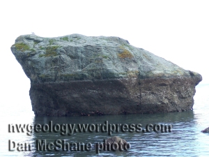
White Rock, Hood Canal. Not in the inventory yet. Many of the erratics on the Northwest Geolgoy Field trips website aren't listed (yet). Maybe that is your job!

White Rock, Hood Canal. Not in the inventory yet. Many of the erratics on the Northwest Geology Field Trips website aren’t listed (yet). Maybe that is your job!

The Washington Glacial Erratics website has re-opened for business. Managed by the undergraduate GeoClub within the Earth and Space Sciences Department at the University of Washington, it is an inventory database and map showing “significant erratics (i.e., large, diameter >8-10 feet , or has a unique composition or features)” in Washington State. Anyone can add their favorite glacial erratics including photos and a description. You will need to know coordinates (UTM or Lat/Long). Visit the website at http://waglacialerratics.ess.washington.edu/ At present (February 9, 2014) there are 12 erratics shown. Get busy!

Dave Tucker

I ar a perfeshunal jolojy riter!

Dear friends,

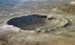
This photo appeared on teh 'meteor craters' post on Ask Dr. Rock.

This photo appeared on teh ‘meteor craters’ post on Ask Dr. Rock.

I have been hired by an acquaintence to produce a geology blog twice a month. It is called ‘Ask Doctor Rock’ and can be found at http://askdoc-rock.blogspot.com/. The blog is one of several associated with RVtravel.com based in Edmonds, Washington. I’ve been getting paid for my screed since last January. That makes me a perfeshunal riter.

The website’s many readers are invited to send questions about the roadside geology they see on their travels. Some ask about cool places to go so they can plan future trips. A few questions are more esoteric: “What’s the difference between the Cascades and Sierras?” The topics range pretty far from the bounds of Northwest Geology Field Trips: all the way to Florida and New England so far, but several have focused on places in the great Northwest, too. I recently wrote about the effects of sea level rise from global climate change, and got some unpleasant comments. That topic seems to anger some people. Ordinarily I write straight geology. I have to scramble to come up with good answers for questions about places I have never been to and rocks I have never seen. Ain’t the internet just great?

Readers from my website are welcome to send in questions. Write Dr. Rock (yers trooly) via a comment at the Dr. Rock blog.

This one illustrated "Why si the Midwest so flat?"

This one illustrated “Why is the Midwest so flat?”

Washington Erratics website temporarily down

Dear friends,

The new Washington Erratics website is temporarily down while a glitch is dealt with. Please do not send in new material until further notice. Anticipated reopening date is November 1. I’ll send out a post when the webmaster there gives me the thumbs up. http://waglacialerratics.ess.washington.edu/

Alan Kearney photos document glacial recession in the northern Cascades

Alan Kearney’s photos showing South Cascade Glacier’s retreat, 1981 to 2006. Click to enlarge.

I posted comparison photos last month showing 100 years of glacier recession on the south side of Mount Baker. (The fundraiser posters are still available- go to the preceding link.) My friend Alan Kearney has published similar comparison photos on his photography blog. Alan’s photo pairs show marked changes in glacial extent and thickness in just the past few decades of his mountaineering career. View his photos here: http://alankearneyphotography.blogspot.com/2012/11/local-ice-photographing-cascade-before.html

Much of Alan’s writing deals with photographic technique, which is interesting in itself. If all you want is glacier comparison photos, scroll down. There are several starting midway and going to the end.

100 years of change on Mount Baker featured in Nov. 5th Bellingham Herald

Bellingham Herald Nov 5, 2012. Click to enlarge

Read the Bellingham Herald article (front page, above the fold in the ‘hard copy’) about the two Mount Baker photos taken 100 years apart. The 1912 photo was taken by E.D. Welsh, the 2012 photo by John Scurlock.

The commemorative posters are for sale by MBVRC as  a fundraiser for the research program.

Finding online geologic information: a Washington Department of Geology and Earth Resources pdf.

The Washington DGER website is being revised. In the interim, a quick way to find links to geologic maps and all manner of information about things such as coal mine history is in this pdf. Click the link below to go to the pdf.

finding_geologic_information (2)

Thanks to my friend Stephen Slaughter at DGER for steering me to this pdf.